
7 Best Hikes Around Cape Town (Maps + Stunning Views)
Cape Town is an amazing city and is blessed with all its natural beauty around. And the best way to see it is to go on the best hikes around Cape Town which are incredibly accessible from Cape Town’s city center.
All of the hiking trails around Cape Town are free, which also makes them a cheap travel activity. But even if you prefer a guide the hikes are so amazing it would be well worth your money. So keep reading to find the best hikes around Cape Town.
1. Lion’s Head (Best Short Hike in Cape Town)
🕐 2 hours return
🚗 10 minutes drive from Cape Town
🥾 Level: Easy – Moderate
🌅 Special: Watch sunset
🔦 Bring a torch or headlamp if you go for sunset
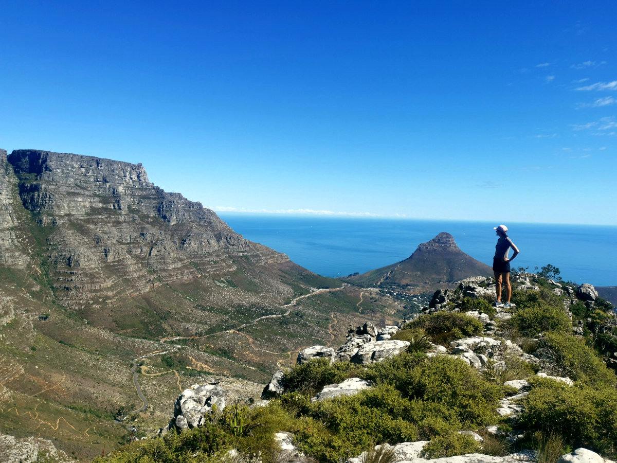
If you are short on time and can only do one hike in Cape Town I recommend Lion’s Head. It is one of the best hikes around Cape Town and we liked it so much that we hiked up more than once.
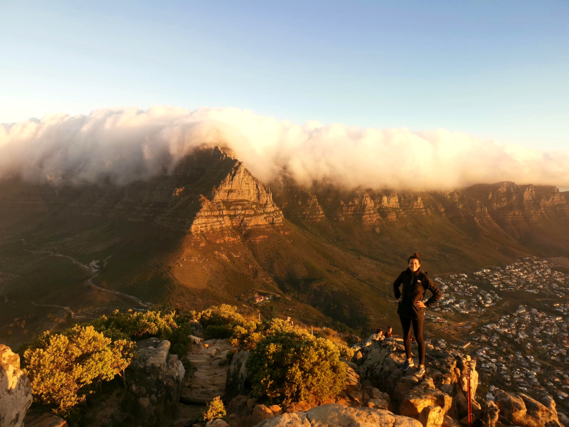
Not only is it one of the most beautiful hikes in Cape Town but if you are in good shape Lion’s Head hike is not too hard either. At the top, you will have amazing 360° views of Table Mountain, Camps Bay, and more!
How to get to Lion’s Head
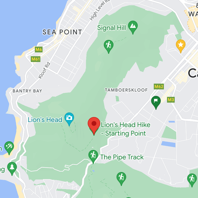
To get to the hike starting point of Lion’s Head you will need to drive or get an Uber to the Lion’s Head Hike Parking Lot, which is marked on Google Maps.
Hiking Lion’s Head
The hike starts out easily with a wide smooth path beginning at the car park. As the path winds around Lion’s Head you will have great views of Table Mountain and the surrounding beaches.
The path starts to get rockier the higher you get and eventually you will arrive at sections where you must climb ladders. One section is very steep and has staples and chains to help you climb.

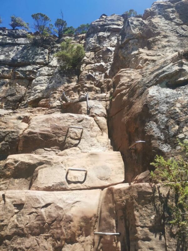
This section is fun if you are into climbing. However, if you are afraid of heights you might find it a bit scary. If this is the case you can simply follow the path to the left of the staples and take the more gentle and longer route up. This is also a good route if it is very busy as there can be lines to go up and down the staples and chains.
After the staples and chains, there is a fairly steep rock scramble to the top, then you can take in the views and relax. I also highly recommend going up to Lion’s Head for sunset. But if you do so remember to bring a headlamp or torch as it will get dark quite quickly after sunset.
Or if you want to can get up early you can book a Lion’s Head Sunrise Tour and watch the sunrise from the top!
2. Skeleton Gorge (Best Green Hike around Cape Town + Secret Beach)
🕐 4 hours return
🚗 20 minutes drive from Cape Town
🥾 Level: Moderate – Hard
🌳 Special: Forest hike + secret beach
💧 Bring lots of water + healthy snacks
Skeleton Gorge is a unique hike in Cape Town because of how green it is. Most hikes around Cape Town will take you through beautiful but quite arid, dry areas. But this hike starts off in the stunning Kirstenbosch Gardens and takes you through lush green forests.
It is quite a tough hike as it will take you to the top of Table Mountain so requires a decent level of fitness. However, when you make it to the top you will be rewarded by a secret beach which makes it one of the best bikes around Cape Town!
How to get to Skeleton Gorge
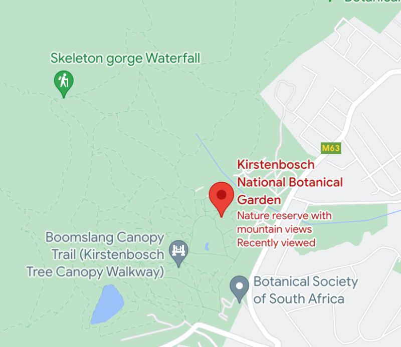
To get to starting point of the Skeleton Gorge hike you will need to make your way to Kirstenbosch Gardens. The entry fee is 210 Rand / 12 USD. Once you are in Kirstenbosch the hike is up the hill at the back of the Gardens.
Tip: There is also a free way to get to the Skeleton Gorge hike if you go through Newlands Forest. However, we have not been that way and the Kirstenbosch Gardens are worth visiting anyway so we recommend this route.
Hiking Skeleton Gorge
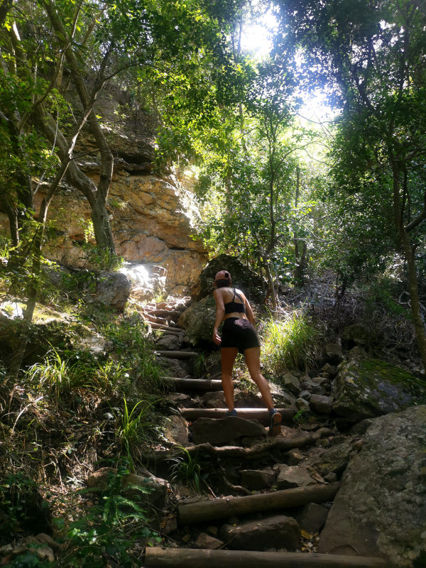
When you are in Kirstenbosch Gardens look out for signposts pointing to Skeleton Gorge. Once you are at the start of the trail it will immediately become very steep and there will be a lot of stairs to climb.
We did the hike on a very hot day and recommend going early in the day if you go in summer. It was incredibly humid amongst all the trees and we were getting quite a sweat on. So make sure you bring along plenty of water and a few healthy snacks.
Eventually, you will arrive at some areas that are very steep. So there will be some ladders and handles on the rocks to help you climb which is good fun and brings your heartbeat up.
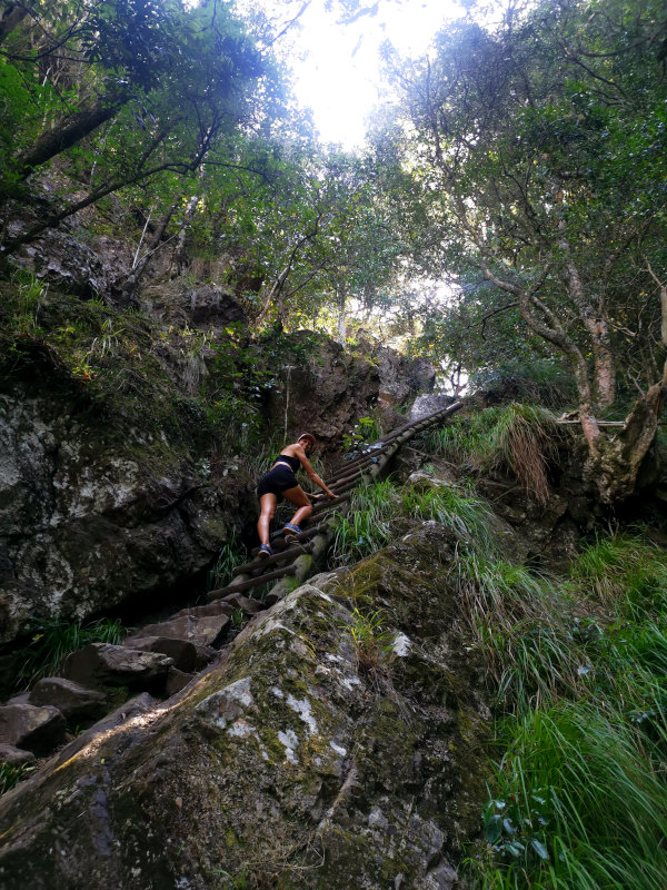
As you get closer to the top the forest cover will disappear and you will have a great view over Cape Town. Once you are at the top you should find some maps on concrete posts showing you the way to the Hely-Hutchinson Reservoir.
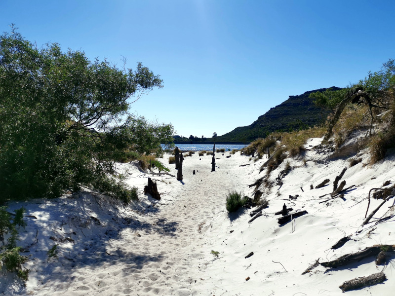
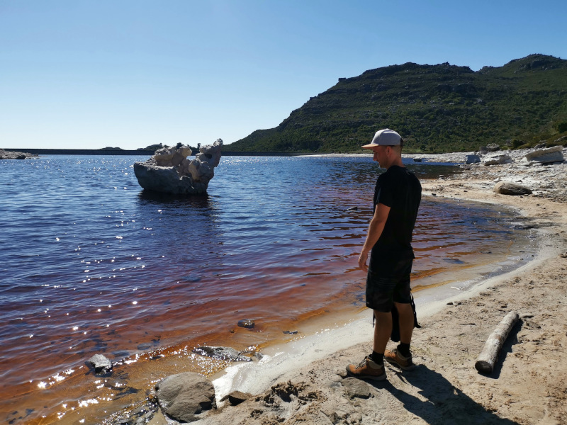
This is where the secret beach is where you can cool off after your hike! The water in the lake at the top is a deep brown color but the color is from plant matter so it is totally safe to have a swim.
The water reservoirs you can see at the top of Table Mountain used to supply the city with water many years ago. They are surrounded by sand dunes so it feels like you are at the beach.
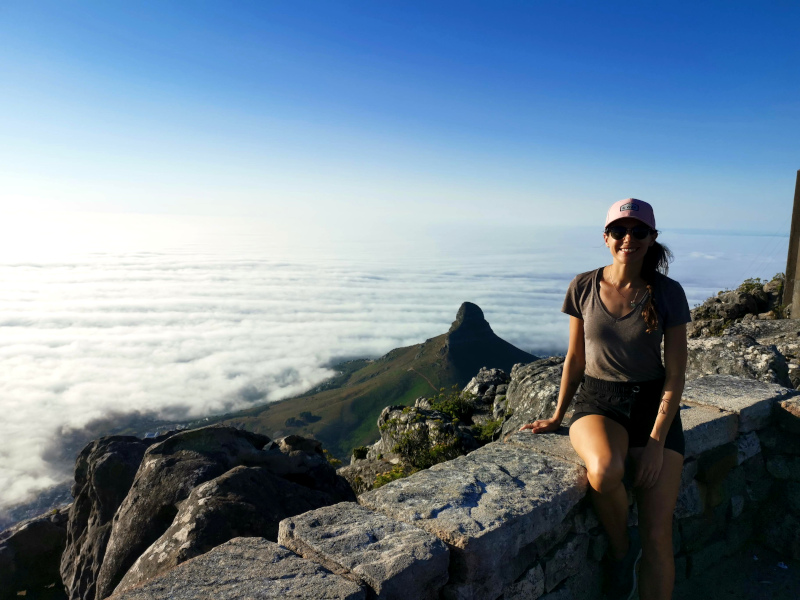
Once at the top, you can either go back down the same way you came up or if you have more energy you can follow the path to Maclear’s Beacon which is the highest point on Table Mountain.
We took this route and hiked all the way from Maclear’s Beacon to the cable car which we took down Tables Mountain.
This was a very cool route! However, it should only be attempted if you are in very good shape and have plenty of food and water. We underestimated how tough it would be and were quite dehydrated by the time we arrived at the cable cars, so bring as much water as you can!
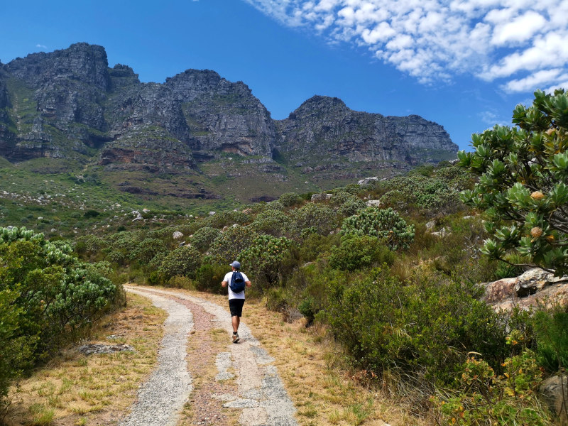
3. Kasteelspoort (Best Hike around Cape Town with Unique View Point)
🕐 4-5 hours return
🚗 20 minutes drive from Cape Town
🥾 Level: Moderate
📸 Special: Diving board rock formation
💧 Bring lots of water + healthy snacks
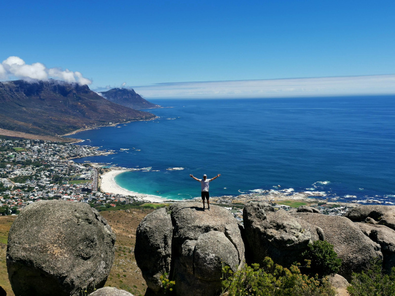
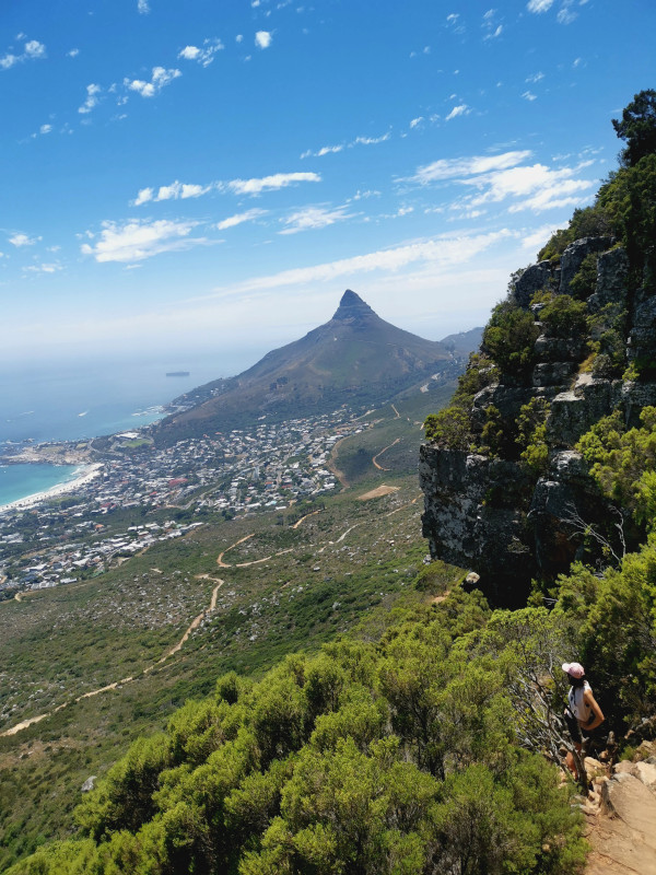
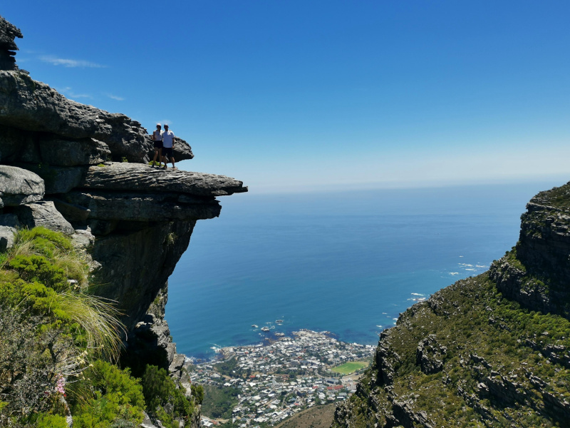
Kasteelspoort is a very beautiful but tough hike up Table Mountain. As there are no easy ways up Table Mountain! It has great views of the ocean and a spectacular ‘diving board’ rock formation at the top.
We really liked this hike because compared to other hikes up Table Mountain there were only a few people on the trail. Also being able to see the ocean the whole way up was really beautiful.
If you like a thrill like me you can get a photo on the diving board, the awesome rock formation at the top of the hike. Overall it is definitely one of the best hikes around Cape Town.
How to get to Kasteelspoort
There are two options to get to the starting point:
- You can walk along the Pipe Track until you see the sign pointing toward Kasteelspoort. This will add another 45 mins to the hike
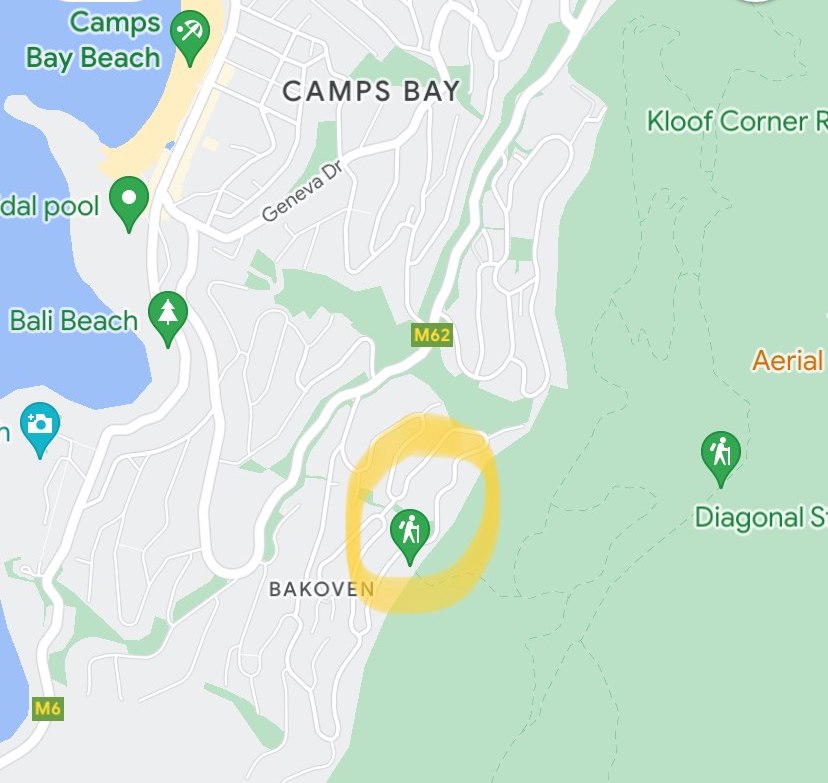
- Or you can drive or Uber to the Kasteelspoort starting point on Theresa Ave behind Bakoven Beach. This is the route we chose to take.
Hiking Kasteelspoort
The start of the hike will begin relatively easily on a wide road that is quite steep from the beginning. When this road reaches the Pipe Track you will need to take a left until you see a sign pointing to the Kasteelspoort trail.
Once you are on the Kasteelspoort trail it will immediately become a lot narrower and steeper. The path will go steeply directly up the hill and there will be some small rock scrambles along the way.
As you get higher and higher it will be quite tough as it is incredibly steep. But there are plenty of really nice spots to stop and take in the view over Camps Bay.
After about 2-3 hours depending on your speed, you should be at the top. Then if you want you can take your picture on the diving board!
The pictures make it look a bit scarier than it is, as there is actually quite a bit of space on top. Just be careful if it is windy as Table Mountain often has very strong winds!
Once at the top, you have two choices to make. You can either head back down the mountain the same way you came up. Or you can walk The Valley of Red Gods path that will take you to the cable car. This is what we did.
The Valley of Red Gods takes you through the middle of Table Mountain. There are some decent climbs but also some very nice viewpoints along the way to the cable car. So if you have the time and energy it is a great route with almost no people.
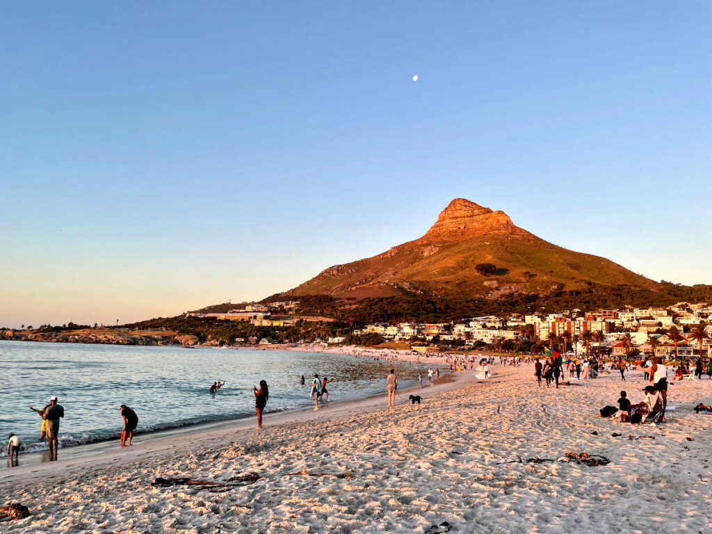
4. Devil’s Peak (Most Underrated Hike around Cape Town)
🕐 4-5 hours return
🚗 20 minutes drive from Cape Town
🥾 Level: Moderate
😎 Special: 360° View over Cape Town
💧 Bring lots of water + healthy snacks
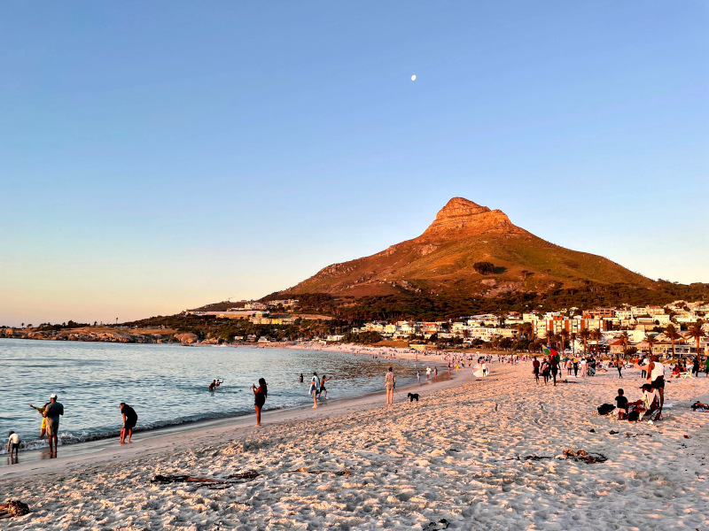
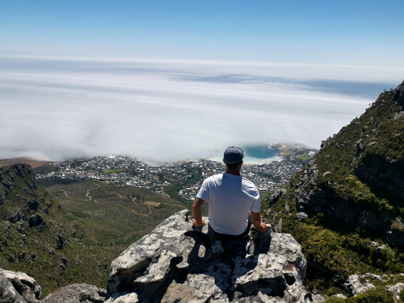
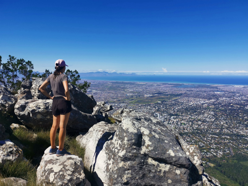
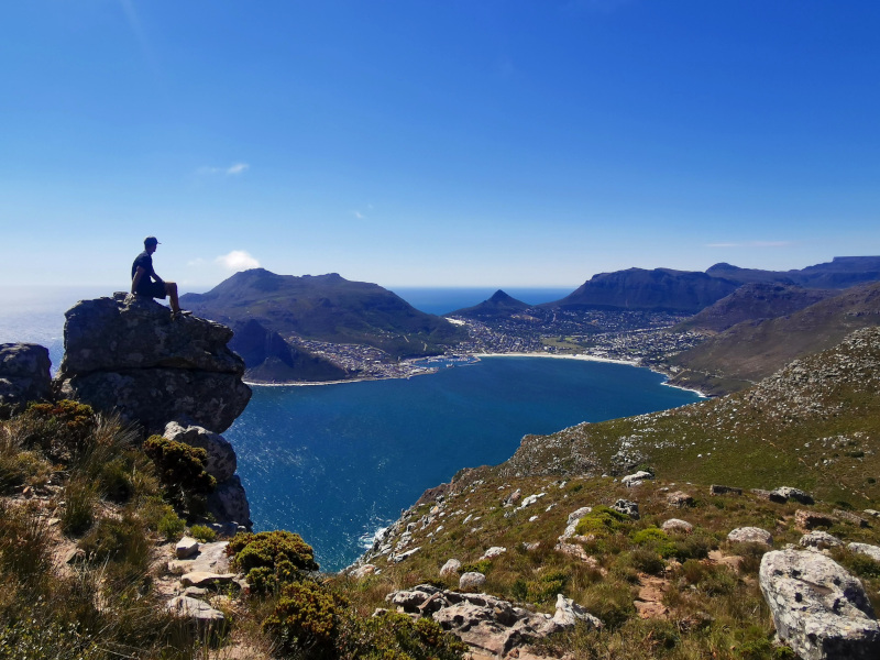
Devil’s Peak is a hike that is in my opinion really underrated. From ground level, it does not look as impressive as Table Mountain and Lions Head as its shape is not so unique. But because of its position, at the summit, you will have an amazing 360° view looking at Table Mountain and the whole of Cape Town.
In one direction you will be looking across the face of Table Mountain towards Lions Head and the Atlantic Ocean. While in the other direction, you can see Constantia, Muizenburg, and False Bay. Due to the unique perspective at the top, I think that it is one of the best hikes around Cape Town and highly recommend it.

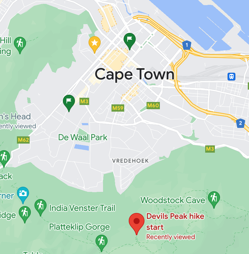
How to get to Devil’s Peak
To get to Devil’s Peak you will need to drive or take an Uber past the Table Mountain cable car station to the Devil’s Peak hike starting point on the map.
Just a warning that if you take an Uber you may have trouble getting one to pick you up when you come down. We could not get one so we hitched a ride with another hiker who has just finished the hike (thank you!). So if you can’t get an Uber I recommend you try and ask for a ride.
Hiking Devil’s Peak
The start of the Devil’s Peak hike is clearly signposted on the side of the road. You will start by immediately climbing some stairs. The hike is very exposed to the sun in the afternoon so if it is a hot day it would be best to start in the morning.
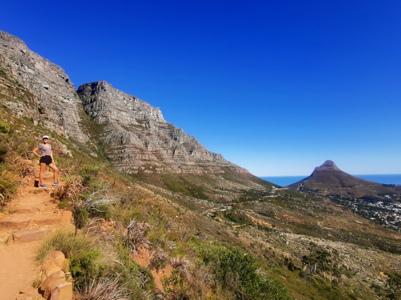
The path zig-zags up the side of Table Mountain for about 40 minutes before flattening out and heading toward Devil’s Peak. When you get to saddle rock you turn right and take the path straight to the top.
The path is very steep over the last sections towards the top so be prepared for a fairly tough climb. There are a few spots slightly off the path where there are some great viewpoints on the way up.
So go explore! But of course, never stray very far from the path as it can be very dangerous to do so on Table Mountain.
Once you are at the top you will have 360° views and lots of spots to stop, rest and take it all in. Then just head back down the same way you came up.
5. Chapmans Peak (Least Busiest Hike around Cape Town)
🕐 3-5 hours return depending on the starting point
🚗 40 minutes drive from Cape Town
🥾 Level: Easy – Moderate
⛰️ Special: Take the Chapman’s Peak Drive
💧 Bring lots of water + healthy snacks
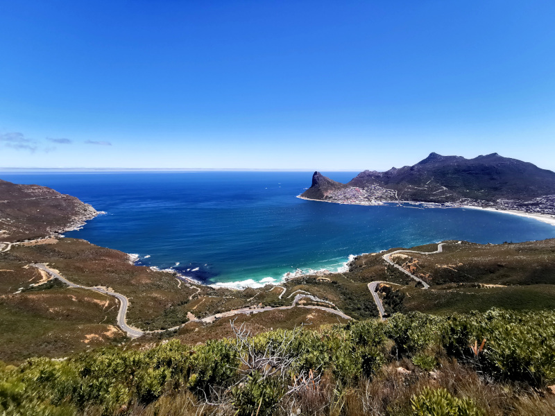
Chapmans Peak is the farthest from Cape Town of all the hikes we have mentioned so far. From the top, you will have spectacular views across Hout Bay and to another side of Long Bay. It is a much different view than all the others on the list and one of the best bikes around Cape Town.
Also before or after the hike you can take a drive along Chapman’s Peak Drive. This road is considered to be one of the most beautiful drives in the world and is on our list of fun activities to do in Cape Town.
How to get to Chapmans Peak
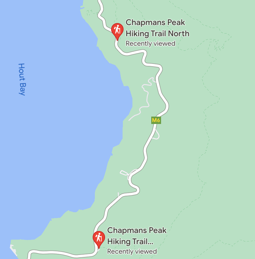
When you google Chapmans Peak Hike it will come up with three options:
- Chapmans Peak Hiking Trail North
- Chapmans Peaking Hiking Trail
- Chapmans Peak Hiking Trail South
For the standard hike, you should go to Chapmans Peak Hiking Trail, not North or South. The start is clearly signposted. The North Trail is the most far away from the summit and the South one is the closest. Chapmans Peak Hiking Trail is located in the middle.
We had a bit of confusion with our Uber driver and ended up at the North Trail. It is a much longer hike but if you have the time I would recommend it. As you will end up at Chapmans Peak while having amazing views of Hout Bay along the way.
Hiking Chapmans Peak
The path begins straight from the car park at the start of the hike. The path goes steeply up the hill for about 30 minutes before you come to a crossroads in the path where you must take a right turn.
When you make the turn the path will be less steep here and there will be awesome views of Hout Bay.
As you go along the path it will look like you are getting closer to the top. But there is a bit of a false summit and the true summit is further on.
There are a few minor rock scrambles and then you will be able to enjoy the view from the top. You will have an awesome 360° view of Hout Bay, Table Mountain and Long Beach.
The views from the top are amazing and make Chapmans Peak one of the best hikes in Cape Town for sure. Just a warning that if it is windy in Cape Town the summit may be incredibly windy too as it was when we were there.
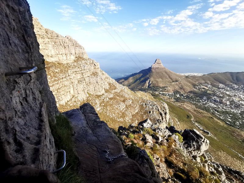
6. India Venster (Best Hike around Cape Town for Adventurers)
🕐 2.5-3 hours to the top
🚗 15 minutes drive from Cape Town
🥾 Level: Hard
⛰️ Special: Climbing on edges
💧 Bring lots of water + healthy snacks
India Venster is by far the most adventurous trail on this list. The trail takes you straight up Table Mountain underneath the cable cars and is not for the faint-hearted. It is a very steep climb but you will be rewarded with some amazing views of Lions Head and Camps Bay.
The hike gets its name because of a rock formation on the way up that looks like the Indian subcontinent. ‘Venster’ is the Afrikaans word for window.
There are some sections where you are required to do some rock scrambles and climb some chains and ladders. It is similar to Lions Head but it is much higher and longer. The path is well-marked with yellow footprints on rocks to show which way to go.
I did the hike solo for the first time and had no problems. However, if you are not confident navigating out in nature or are scared of heights I would recommend getting a guide or joining a group to go up.
There are some very exposed sections and if you stray off the path it could be very dangerous. There have been several deaths on India Venster so only go solo if you are confident.
How to get to India Venster
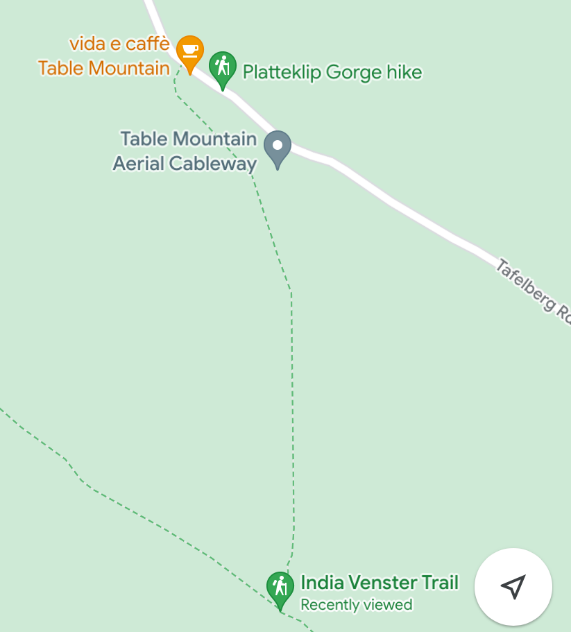
To get to the India Venster hike start point make your way to the Table Mountain cable car station. Once you are there look for the Vida e Caffe cafe and the starting point to the trail will be on the right.
The hike is fully exposed to the sun during the day so on hot days it is best to start early in the morning.
Hiking India Venster
The trail goes up the hill behind the cable car station and starts off moderately steep. You will shortly arrive at a crosspoint with another path where you need to follow the signs. They will point you up the hill where there will be some minor rock scrambles as the path gets steeper.
I will not get into a detailed description of which way to go as there are a number of rock scrambles and a section with chains to climb. I found my way up fine but I must emphasize that if you do not have a good sense of direction or are afraid of heights you should definitely get a guide or join an experienced group.
You can book an India Venster Tour here where an experienced guide will ensure you get past the dangerous points safely. The scrambling and ladders are great fun and are a part of the reason I think it is the best hike in Cape Town.
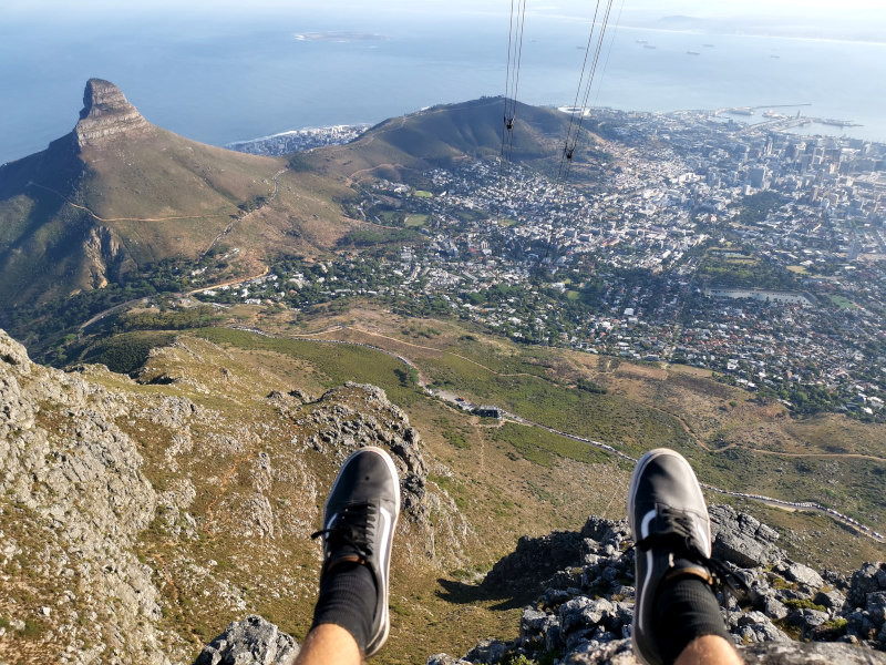
Once you get to the top underneath the cable cars the path goes around the corner where you will have amazing views looking right down at Camps Bay.
The path then takes you to a junction where you can either go down Platteklip Gorge or take the cable car down. Personally, I would recommend taking the cable car down as I walked down Platteklip Gorge on another hike and didn’t find it a fun experience.
Platteklip Gorge is a steep valley without an impressive view made up of hundreds of steep stairs you will feel for another week 😉 But if you want a fitness challenge then go ahead!
7. The Pipe Track (Easiest Hike in Cape Town)
🕐 3 hours return
🚗 15 minutes drive from Cape Town
🥾 Level: Easy
🌅 Special: Watch the sunset
The Pipe Track is by far the easiest hike on this list. It is a good option if you do not feel like an overly tiring hike and is the best hiking trail in Cape Town for beginners.
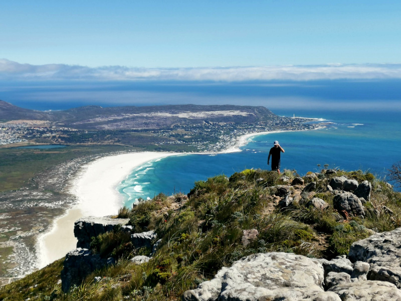
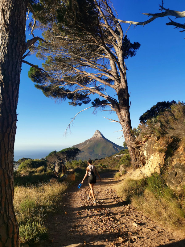
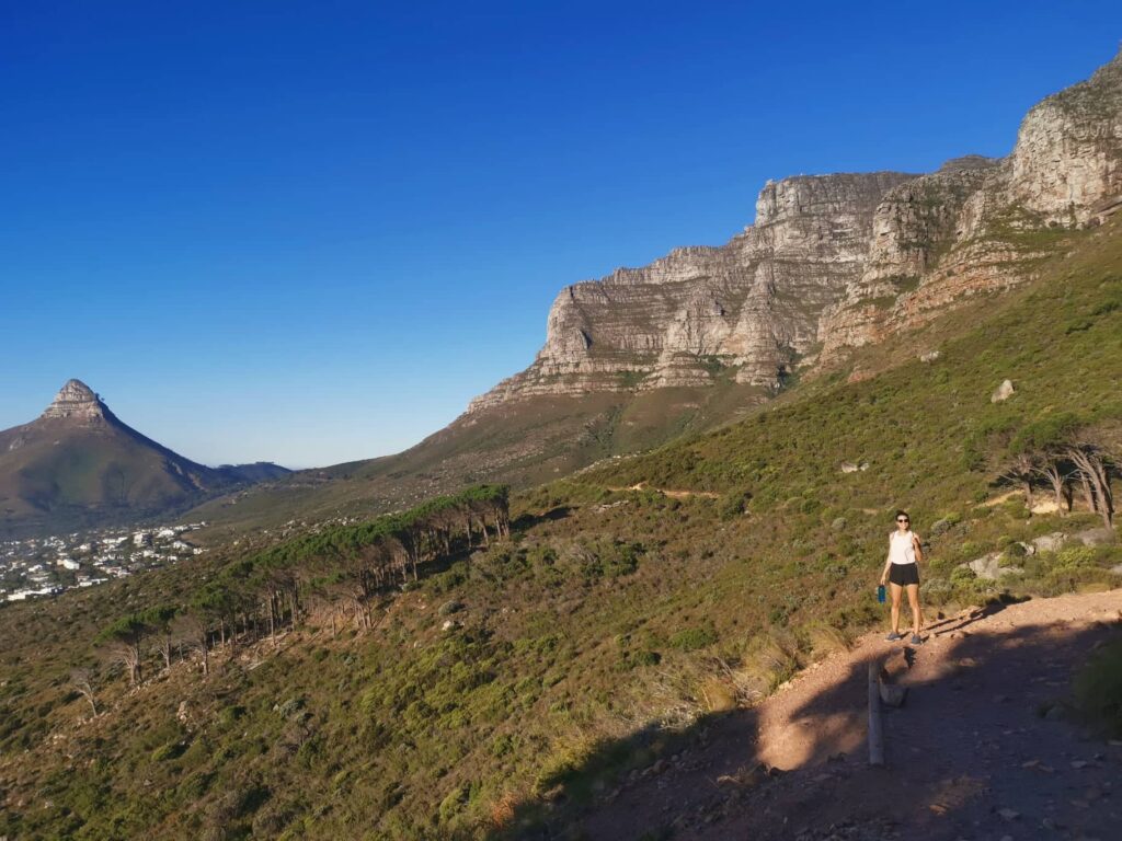
The track starts at Kloof Corner up behind Camps Bay and makes its way along the cliffs of Camps Bay towards to Kasteelspoort hike starting point. Along the hike, you will have spectacular views of Lions Head, Camps Bay and the 12 Apostles of Table Mountain above.
We did the hike close to sunset and found that it was particularly nice to do the hike at this time. As the sun was low in the sky there was a golden glow on Lions Head and Table Mountain and the temperature dropped a little.
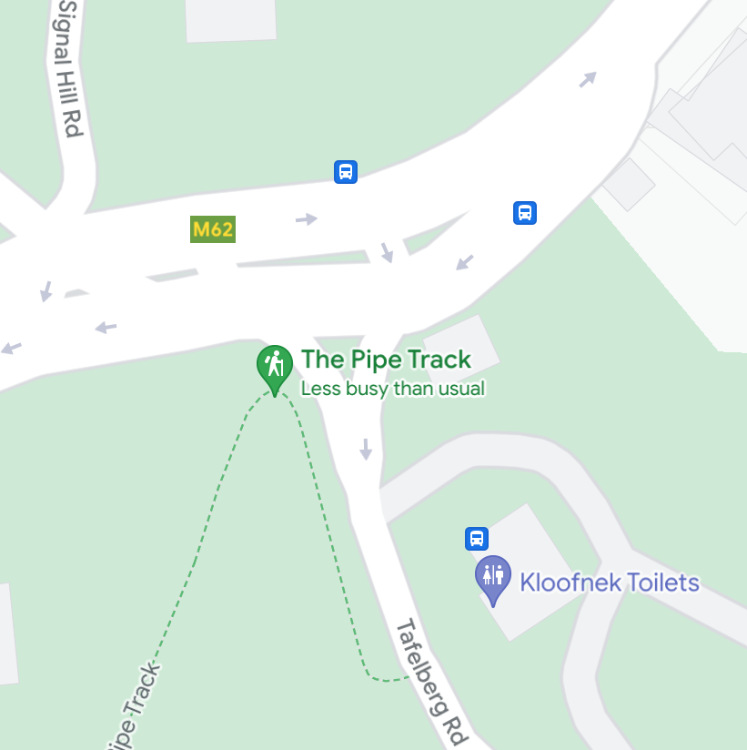
How to get to the Pipe Track
To get to the Pipe Track starting point you need to make your way to the start of Tafelberg Road. This is the road that leads up to the cable cars up Table Mountain.
At the very beginning of the road, you will see a block of toilets next to a parking lot. The start of the trail is directly across the road from this parking lot.
Hiking the Pipe Track
Compared to all the other hikes on this list the Pipe Track is very flat and not too tiring. The beginning of the track has some downhill sections before it winds up into some ravines.
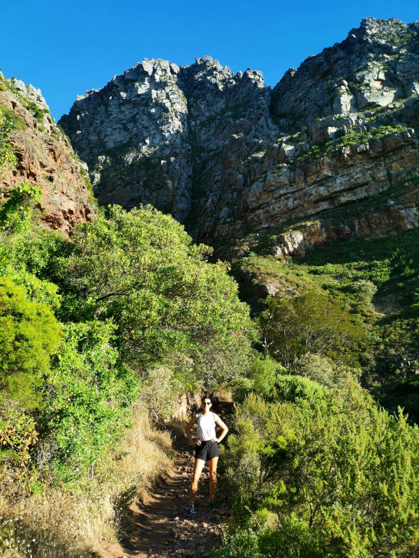
For most of the track, the trail just meanders along the face of the cliff. However, the path has a lot of loose rocks in sections so make sure to wear appropriate shoes.
Along sections of the track, you may see some pipes that give the track its name. The pipes you see were used to transport water from reservoirs on the top of Table Mountain for use in the city.
Just after you see the sign for the Kasteelspoort hike there will be a road that will take you down to Bakoven Bay. We went to Bakoven for sunset and highly recommend it.
Otherwise, not too long after the sign for the Kasteelspoort hike, you will come to the end of the Pipe Track and it is time to turn around. Even though it is an easy hike in Cape Town it is still super beautiful and well worth your time.
The Pipe Track is also one of the few child-friendly hiking trails in Cape Town so is great for families. You will also see quite a few runners or people with dogs.
Now you know the Best Hikes around Cape Town
Hiking was our favorite activity while we were in Cape Town and you are missing out if you don’t go on at least one hike while you are there. All hikes on this list are easily accessible from Cape Town and will give you the best views of the city and surroundings.
Due to Cape Town’s geographical location, there are many more hikes to explore. But this list gives you a perfect start when you are visiting Cape Town for the first time.
If you have any questions or recommendations for what you think the best hikes around Cape Town are please comment below!
READ ALSO
Hey there! Some of the links on this page are affiliate links. This means that if you choose to make a purchase we may get a small commission at no extra cost to you. These commissions help us to generate income and keep creating content for you. So we greatly appreciate your support! Thanks!
Hi, I am Allan, a travel, health and fitness fanatic from New Zealand. I'm a former lawyer who turned into a full-time nomad in 2020. For the last 4+ years I've been traveling the world. I'm always on a hunt for good food, activities on a budget and workouts on the go. I hope you find my tips helpful and get inspired to travel more!
It was mOUNTAIN mAN Academy Pty Ltd honor to have crossed paths with this amazing couple. I will definately be using this for my hikers in future. I find it very clean crisp and well researched as I have been in our mOUNTAINS for the last 3 years x 365 days x 8 hours. Well done for a very well documented blog. Happy trails and I will be following your other travels closely.
Thank you so much! It was a pleasure to meet you and we are very greatful for the lift you gave us after finishing Devil’s Peak hike. We hope to be back in Cape Town to do more hikes and cross path with you again.